Drawn for the Insurance Men, 1890 to 1916
The maps that drew the whole truth
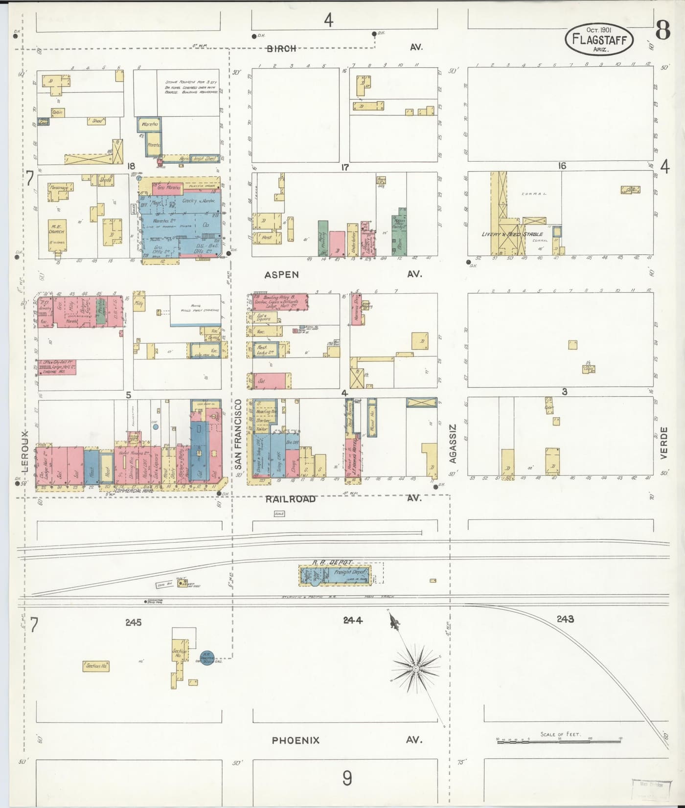
Sanborn surveyors mapped every building in Flagstaff so insurers could price the fire risk. They did not editorialize. They just wrote Sal. on the saloons, one after another, and inked the district like any other block. The cover of Wicked Flagstaff is built on these sheets.
Saloon Row, as insured
The Railroad Avenue frontage between Leroux and San Francisco streets: saloon, saloon, saloon and liquors, the Commercial Hotel over the bar, the bowling alley and billiards hall around the corner, and the city jail a convenient block away. The Methodist Episcopal church holds the top of the sheet, keeping an eye on all of it.
This is the block the saloon chapters of the book walk. Zoom the Library of Congress scan and you can read the era building by building.
The Weatherford, one year old
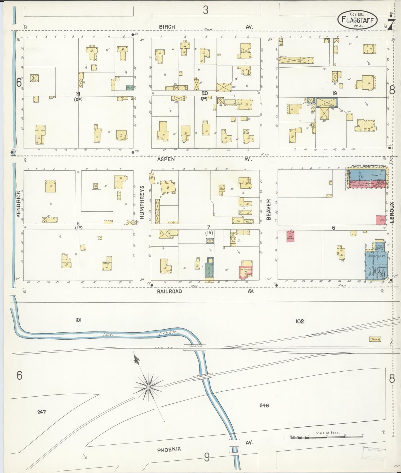
On the same 1901 survey, the Hotel Weatherford appears at Aspen and Leroux, one year into its run as the finest address in town: hotel rooms, dining room, sample room, and bar, each labeled in the surveyor’s shorthand. The saloon economy and the respectable economy were the same economy, one lot apart.
Browse the sheets yourself
The Library of Congress holds six territorial-era Sanborn editions of Flagstaff, all public domain, all zoomable to the single building. The book will tell you what happened at the addresses; the maps will show you the floor plans.
- Sanborn map of Flagstaff, October 1890
- Sanborn map of Flagstaff, December 1892
- Sanborn map of Flagstaff, July 1895
- Sanborn map of Flagstaff, October 1901
- Sanborn map of Flagstaff, October 1910
- Sanborn map of Flagstaff, January 1916
Cite this page
Chicago“The Sanborn Maps of Flagstaff.” Wicked Flagstaff, the Book. https://wickedflagstaff.com/maps.
APAWicked Flagstaff, the Book. (2026). The Sanborn Maps of Flagstaff. https://wickedflagstaff.com/maps
Citing the book itself? Edition details and ISBNs are on the buy page.